To see your future profession in process, learn about its specifications and take advice from experienced specialists - that was the opportunities offered during an excursion to an enterprise. The Department of Geodesy and Geoinformation Systems and Tourist and Excursion Centre of Polotsk State University provided a GEO-tour around Belarusian geodetic enterprises for the students and international prospective students.
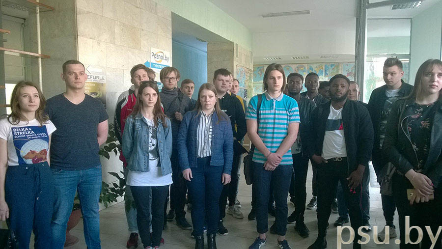
During the journey to Minsk, the participants visited various geodetic enterprises, learnt about their technologies, working days, achievements of modern geodesy and mapping and what to pay special attention to during the studies at the university.
Topographic and Geodetic Republican Unitary Enterprise “Belgeodesy”
“Belgeodesy” is the leading geodetic enterprise in Belarus. It performs public and special interest surveying works for the needs of economic sectors and in the interests of defence and state security.
A lot of the enterprises’ employees are our graduates, including the director of the enterprise Sergey Zabagonsky, chief engineer Alexander Prisyazhnyuk, head of the department of high-accuracy positioning Valery Krasutsky.
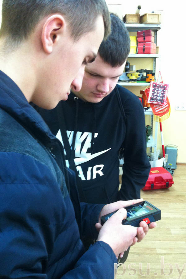
The students were shown how to use the equipment for metrological research of geodetic instruments and leveling rods. Besides, the repairs of any complexity are conducted here for the instruments delivered from all over the country.


Later, the students visited the Centre of Satellite System for High-accuracy Positioning Service Supply of the Republic of Belarus. Dmitry Vasenda, the Head, spoke about the technology of receiving and processing data, its applications and delivery to the end user. Satellite technologies were of special interest for the listeners as it is a modern and promising area in a wide range of industries.

Republican Unitary Enterprise “Belcartography”
“Belcartography” provides maps and atlases of miscellaneous purpose. Dmitry Makarevich, an editor, described the company’s work and its products to the students.

Tatyana Prokopovich, the lead editor, informed the students about the stages of maps creating: from author’s original processing to printing. Lots of her products were awarded prizes at various prestigious republican and international competitions and exhibitions.


After that, Sergey Yakimovich, the Deputy Director for General Management, expressed his warm wishes and gave useful souvenirs to the students.


Unitary enterprise “Geoinformation Systems” of National Academy of Sciences of Belarus
The “Geoinformation Systems” enterprise is one of the main developers of Belarusian Space System of Remote Sensing of the Earth. Since 2004, the enterprise has been the national remote sensing operator. Besides, “Geoinformation Systems” provides uninterrupted operation of Belarusian spacecraft for more than 20 Belarusian organizations. Besides, it conducts research in the sphere of remote sensing of the Earth, informational and telecommunication technologies, design, development and creating of geoinformation systems.
Vasily Sivukha, the head of the operation centre for Belarusian Space System of Remote Sensing of the Earth, gave a tour around the enterprise.

Vasily Sivukha showed the work of the Centre for Flight Control of Belarusian Spacecraft. In addition, V. Sivukha informed the listeners about the first satellite, its operational features, flight control, costs, reception and thematic processing of data. Besides, the students learnt about the space industry development directions in Belarus and about the new Belarusian satellite development.

During the excursion, the participants took a closer look at their future profession. They saw with their own eyes that geodesy is a high-tech industry that keeps up with the times and needs state-of-the-art knowledge and the latest developments in science and technology.

The students shared their impressions:
Yekaterina Biznya, 2nd-year student: “I am pleased with the excursion. I learnt about the enterprises activities in detail. Having visited ‘Belcartography', I can say that maps creating is a painstaking work, that needs much attention to detail, self-possession and exactitude. It was exciting to visit the laboratory at ‘Belgeodesy’. And I think that I have decided on my future place of work”.
Alexander Prokopovich, 2nd-year student: “For me, as for the future professional, the excursion was very informative and useful. I was especially impressed by the Centre for Flight Control of Belarusian Spacecraft at the unitary enterprise ‘Geoinformation Systems’”.
Nazar Savchenko, 1st-year student: “I enjoyed the excursion to ‘Belgeodesy’. I saw how demanded and interesting can be the future job of a geodetic engineer”.
Galina Sharoglazova, Head of the Department of Geodesy and Geoinformation Systems
Marina Voloshina, senior lecturer at the Department of Geodesy and Geoinformation Systems
Marina Makarova, assistant at the Department of Geodesy and Geoinformation Systems